Showing posts with label GPS. Show all posts

Tuesday, April 6, 2010

Ovi Maps 3.3 with free navigation review

About 2 1/2 months ago Nokia announced that they will be making its turn by turn voice navigation service on Ovi Maps for free and sure enough version 3.3 (3.03) soon turn up and allowed just that. I've been using the version for a couple of weeks now, chiefly on my E55, and have been very pleased with the experience. It is available for a number of modern Nokia Symbian devices with built-in GPS receiver.

Firstly, this service is available in 76 countries and will tie in nicely with their already available offline feature. The offline feature is brilliant as it allows the user to freely download maps from 180 countries through a desktop terminal thus saving on over the air data costs. If you wish you can also download maps as you go. Map tiles will be saved to the memory card so you would not have to redownload the area again. It also includes free traffic updates and premium content from Lonely Planet and Michelin.


The user interface has changed somewhat from previous versions. I initially had my doubts on new interface, which was clearly designed for touchscreen users, but soon got used to it. I still prefer the previous version as the UI then was designed for hardware soft key phones like the E55, and work faster than this new grid based UI. Still it works fine, but I do still wish that it would boot straight to the map rather than the menu.

Numerous keypad-based shortcuts exists that will make your life easier especially now that they've removed many of the functions from the menu. Pressing '5' for example will disable/enable the digital compass if your device supports it. '*' and '#' respectively controls the zooming.


With Ovi Maps 3.3 and above, Nokia has integrated their 'Here and Now' service, so far consisting of only two widget-like apps: Weather and Events. Both are rather good, though seems to be rather slow (they are web-based after all). The service is still patchy - for example Events suggested the Cineworld Luton, a good 9.5 miles away from here (St. Albans), when there is a Vue much nearer in Watford. Similarly there is no such listings from events hosted at the local Maltings Art theatre and Abbey Theatre.


The Lonely Planet and ViaMichelin premium guides fared much better, though the suggestions of places to eat within St. Albans is rather limited. It is understandable for a small village, but with a population of 65k, St. Albans is hardly a small village. I mean we have two railway stations serving this town for goodness sake.

In any case the listings are accurate and more importantly, seems to be based on quality. You won't find any crappy chain stuff here (not even the good ones like Pizza Express).


The search engine has been simplified dramatically. A search field exists for both addresses (including support for full seven characters UK postcodes) and POIs (where you will find the chain stuff like Pizza Express), with no seperate fields for annoying stuff like house numbers and counties.

Using it is easy - just type in and a second or two later the screen will be populated with suggestions, sorted by distance. Scroll to the desired entry and press the left soft key will bring up the map showing the entry or use the centre d-pad key to bring up a list of handy options allowing the user to use the entry for navigational purpose or even to call any phone numbers associated with that entry.


The rest of Ovi Maps 3.3 works pretty much the same as previous version. You can adjust the route calculating algorithm with options like avoiding the motorway, tunnel, ferry, toll road, unpaved road and trains. Similarly it can also suggest route optimised for pedestrians. Route suggestions seems to be fairly good, though this is merely based on my personal experience and opinion. I can't test the quality for the whole UK now can I?

Like other popular SatNav products (such as TomTom), you can change the screen to 'night' mode which works better on the eyes. GPS lock is almost instantaneous if A-GPS is activated. It takes about 5 seconds for a cold lock and less than a second for a warm lock. Impressive, but this has got to do more with the device hardware and firmware than the application itself.


Nokia is under no obligation make its navigation service for free, period - especially to older models for which this feature was never promised upon. But for those with compatible Symbian phones (those with built-in GPS receiver), this update is not something to be missed. All in all, this is easily the best smartphone routing application I have used - even without the free navigation. It is even capable of replacing dedicated satnav particularly if pair it with a touchscreen device with larger screen. Best of all, minus the cost of the device, it won't even cost you a penny.

Ovi Maps with free navigation is available for Nokia N97, N97 mini, N86 8MP, 5800 XM, 5800 Navigation, X6 16GB, X6 32GB, E52, E55, E66, E71, E72, 5230, 6710 Navigator and 6730 classic.

For those without compatible devices, Ovi Maps navigation license is available for less than 10 euros a year, still much better value than the majority of mobile routing applications.

Monday, June 29, 2009

Nokia E75 GPS review

Like the Nokia E71 and E66, the E75 is one of Nokia's now many Series 60 smartphones to be supplied with a built-in GPS receiver with A-GPS and digital compass functionality. The GPS can also be assisted via the downloading of ephemeris data that helps with speed. Like the E66, it took me around a minute to get a fix from cold boot on a clear day, though it can take up to a couple of minutes in cloudy days. It also happens to work from about 3 feet in doors in a clear day. I am not sure which GPS receiver chipset the E75 uses, but it works just as well as my SiRFstarIII powered Navman B10.

I recently took the E75 to the Lake District in Cumbria as my GPS companion. I also have my trusty E51 and Navman B10 which I keep in a dry sack as a backup device. The obvious advantage of having it the E75 is it is integrated and you do not have to worry about carrying multiple devices. On the downside it appears to run out of battery faster than my E51+B10 combination, when it comes to navigation. Still it lasted more than seven hours (with the phone portion off) before the battery gave up, which is good enough for a day's walk. It works with Nokia Maps 2.0 and ViewRanger, the application which I use to the test the E75's GPS navigation capabilities.

I found the amount of the time to get fix from cold boot to be about on par with most devices with built-in GPS receiver, in that not so great but acceptable. Without resorting to A-GPS, the receiver took around three minutes to get a fix under a cloudy day (it was very cloudy in the Lakes when we were there). Once a fix is gained it retains to the fix pretty well. A dedicated application GPS Data allows you to check your position, accuracy level, altitude, speed of movement, trip distance, satellite status, calibrate the altitude, selecting the positioning method (GPS only, Assisted-based, Bluetooth-GPS and Network based) and other advance settings.


I am reusing the screenshot from my E66 review of the GPS Data application as it is essentially the same...

The battery life of the E75's on GPS is no match for my E51 and B10 combo, but it is still far better than I initially anticipated. With the phone but turn off, the E75 lasted more than seven hours. Obviously your mileage may wary: lowering the brightness level and decreasing the amount of time before the phone switches off the display will all help decrease the amount of power needed by the E75.

The accuracy of the E75 based on my experience is around 10-20 metre, which is pretty darn accurate for a none-dedicated GPS receiver. As the E75 isn't designed to be a rugged and waterproof device, the E75 stayed tucked away inside my jacket or trousers for most of the time, which does cause the accuracy to suffer a bit. A little bit of very light rain and mist won't damage it, but I rather not test it further seeing that I do not own this particular unit. I have included a number of screenshots of the track that the E75 recorded via ViewRanger where you can judge the accuracy yourself. I personally think it did fine.


Obviously the hardware is only good if paired with a software that takes full advantage of it, and in this case the E75 comes with Nokia Maps 2.0 (an excellent street based mapping software). It is also compatible with Google Maps, though with Nokia Maps I do not see why you would need it (unless online search is important to you). If you enjoy walking or hiking as I do, make sure you buy Augmentra's brilliant ViewRanger (detailed review here). For £25, the Ordnance Survey GB National Park Landranger 1:50k bundle offers a ridiculous amount of great value for money for those seeking to explore Britain's many beautiful National Parks.

As the E75's GPS navigation performance (with better battery life and slightly better accuracy) is similar to the E66, the conclusion is exactly the same. I do not drive so I won't comment about the E75's performance when it comes to providing turn by turn directions using programs like Nokia Maps - but I do think it will suffice. As far as hiking and trekking is concern, if you do not need super accurate performance then I see no problem with using the E75 as your navigational platform, as long as you can dismiss its margin of error. I find the E75 rather handy to have one with me at all times. It is a blessing having not to worry about packing (and charging) my B10 every other day.

The E75 is available unlocked for around £300 at Amazon UK and US$450 at Amazon.com

My extensive Nokia E75 coverage:
Nokia E75 pictures & first impressions
Nokia E75 camera review
Nokia E75 music and sound quality review

Monday, June 1, 2009

Proporta Ted Baker No Ordinary Designer Charging Kit review

Proporta's Ted Baker No Ordinary Designer Charging Kit is an award winning multiple mobile device charger. I got one recently for this summer's camping trips during when the need for charging multiple portable gadgets (including the all important GPS receiver) is important to me (purists can scoff all you want but I do not care).

Despite being made of plastic, the Charging Kit it is solidly built and at 120g, it is also very light. The two tone coloured case is pretty stylish, though it does pick up fingerprints. A lanyard loop resides on the back and the front contains a Type A USB and a Mini-B USB connector. Inside the solid plastic case resides 3400 mAh of Lithium Ion battery, which in theory ought to charge a standard mobile phone a couple of times before needing a recharge. A switch with a build-in LED is found on the top.

Proporta includes a reasonable amount of accessories to get you started. Included in the sales package is a USB to mini USB cable, retractable cable with inter-changeable connector heads and a USB car charger. The charging connector heads that are bundled allows the device to pair up with Nokia phones, Sony Ericsson phones, Samsung phones, iPods, micro USB (for some Motorola phones), mini USB (HTC smartphones, newer Nokia smartphones, GPS devices) and anything that accepts 4.0 DC (such as the PSP). A cloth case is included allowing you to transport every of these tips safely.

Because the Charging Kit features a standard USB connector, you can easily plug in any USB charger cable you have. The 5v 700 mAh output is actually powerful enough to charge most of my portable devices (except for my camera), though an output of 1000 mAh would have made it better. It took about 45 minutes to recharge my Nokia E51 from its 50% battery level, which isn't too bad.

Recharging the Charging Kit itself is simple. Just plug the included USB to mini USB cable into a spare USB port on your PC and plug the other end (the mini USB bit) onto the Mini-B USB port (labelled 'IN'). You can also charge in your vehicle via the included USB cigarette light car charger or any generic USB wall charger, for example this Belkin USB wall charger. The LED on the top will indicate charge level.

Overall the Ted Baker No Ordinary Designer Charging Kit is a solidly build mobile charger. Even at £25 RRP (you can actually get it cheaper elsewhere), it offers an extremely good value alternative to getting expensive replacement batteries which can only be used on a single device. With the Charging Kit, you have a flexible device that is compatible with a large number of portable gadgets out there. Highly recommend, particularly if you are going on a short holiday away from any plugs.

The Proporta Ted Baker No Ordinary Designer Charging Kit is available from Proporta direct (or via Amazon.com and Amazon.co.uk)

Wednesday, December 31, 2008

My favourite gadgets this year

Not many to choose from really, but I really can't imagine living without all of these:

1. Sony Walkman NWZ-S639F (review)
It is easy to use, has great battery life, available for little of your money and deliver superb sound quality. It even comes with an acceptable pair of headphones.

2. Nokia E51 (review)
A great all around performing Series 60 mobile phone with superb built-quality and low price to match (free on cheapest contract). Brilliantly small and sexy, the E51 is a proof that enterprise phones need not be boring.

3. Lenovo ThinkPad X61 (review)
The sexy X61 continues upon the strong tradition of amazing portability, performance and built-quality of the ThinkPad X-series heritage. Still the toughest consumer level notebook on the market. Has since been superseded by the slightly uglier X200 series.

4. Sony PSP Slim & Lite (review)
With a great (if rather limited) library, amazing screen and all-around versatility, the PSP Slim & Lite is only let down by lazy developers and scratch prone display window.

5. Navman B10 (review)
Dirt cheap Bluetooth GPS-receiver with acceptable accuracy and speed in a petite package. Sadly no longer available.

Hopefully I'll spend less next year.

Thursday, August 7, 2008

ViewRanger off-road topo mobile application review

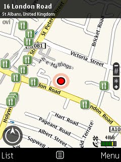
ViewRanger is a topographic mapping, navigation and tracking application for Symbian S60 mobile platform. The concept is simple. Most of us bring our phones with us when trekking or cycling anyway, so why purchase a separate dedicated GPS receiver for outdoor activities when your smartphone is capable of doing so anyway? Sure it won't replace your rugged Garmin 60CXs or SatMap Active 10 (unless you invest in a Boxit case), but for general purpose use or as a backup unit, most phones will do just fine.


ViewRanger supports built-in internal GPS receiver (like the Nokia E66) as well as external Bluetooth GPS receiver that allows the user to turn their phone into an inexpensive topographical navigation system suitable for walkers, mountain bikers and geocachers alike. Maps supported are Britain's Ordnance Survey Explorer and Landranger raster maps, Finland's Maanmittauslaitos and Slovenia. As with any standard topographical mapping programs, ViewRanger allows the user to browse through map tiles and use a GPS receiver to pinpoint their position on the map. The review is based on the recently released software version 2.5.11, which introduced new key features including improved Buddy Beacon support and Over-the-Air map downloads. You can also use ViewRanger to send text/e-mail messages with embedded date & time of GPS reading, speed and heading; useful for emergency situations.


A feature that sets ViewRanger apart from other mobile topographical mapping software like Memory-Map is the ability to view maps in panorama mode. It matches what you see on the horizon with what is on the map, based on the topographical information from Ordnance Survey including every lake, hill and POIs. This is very useful as it allows the user to easily identify the surroundings as well as any POI such as waypoints within the viewpoint. Shadings are used to simulate shadows based on the time of day, but this special effect does make drawing of the maps slow depending. Switching to simple wire frame can improve performance greatly. The top displays the altitude and the coordinates in the national grid reference or if you prefer in other formats like Lon/Lat or UTM standard.


Panorama view allows users to easily identify key points of interests.

Another interesting feature is the ability to create POI using the mobile phone's built-in camera to record photographs within the program. This is very simple, either use the GPS lock or navigate the cursor to the location you wish to create your POI, then select "Take photo & mark". This will automatically launch the camera application and will embed the picture within the POI entry. You can then name or edit the entry, add notes or web links, or view it on the map. Photos can easily be appended on other existing POIs, which can then be uploaded to ViewRanger's online TravelLog server. Licensed POIs can also be downloaded - for example the entire list of nature reserves like those operated by the RSPB. POIs, both shared by other users as well as licensed, can be searched and confined to the vicinity or through categories like tourist attractions or bird sanctuaries; and then saved on the phone for future references. Web hyperlinks can also be added.


Unfortunately, unlike programs like Memory-Map (impressions here) and Fugawi, ViewRanger does not come with a desktop client. This is both a blessing and annoying limitation. By focusing on Series 60, Augmentra has developed a very easy to use program with an abundant amount of extensive features compared to Memory-Map's Windows Mobile application Pocket Nav (which is extremely outdated now). ViewRanger is very stable and has never crashed on me except when testing the beta version. Other features includes the trip meter which is a traditional GPS read-out, similar to what you get with a cycle computer. The UI is intuitive though it will take many hours before you master the menu system, which can get a bit messy due to the number of options and features available. Keypad shortcuts can be easily assigned to suit the user's needs, and the software has been designed from the ground up to be easily used one-handed. "Nightvision" mode can also be toggled, which draws the screen with a red cast designed to preserve the eye's night vision during night walks.


Embed photos taken with your phone's built-in camera, then share it with other ViewRanger users.


Your friends and family can follow your progress on ViewRanger's TravelLog site.

Basically almost anything (and then some) that you can do with desktop programs like Memory-Map be done on ViewRanger, including viewing 3D panoramic viewpoints and setting proximity alarm (Cross Track Error) in case you deviate too far from your route. The downside on this is there are times when one may wish to plan their treks before hand, and it is always better to plan on a desktop application with an accurate mouse and large screen when plotting waypoints. Here's hoping that a desktop client will be released in the future. Fortunately ViewRanger supports importing and exporting GPX files, allowing you to easily plan your routes or view your tracklogs on other 3rd party applications or web-based mapping services. For those stuck with the device only, you will be glad to know that tracklogs can be reviewed within the program for analysis, including graphs showing GPS recorded speed and altitude.


You can analysis your track on the device itself...


...or export it to a desktop app like Memory-Map or even Live Maps.

The feature list is so huge that I haven't had the chance to sample all of ViewRanger has to offer. Buddy Beacon, for example, is a web portal that allows your mates to see your location online as well as through ViewRanger. Users can also track your position within ViewRanger on-screen and vice versa. Facebook users (heh) can also publish their tracklogs using the ViewRanger for Facebook (heh) application, though not being a Facebook user meant that I would not be testing this ever. Another unique feature within ViewRanger that I haven't tried yet is the new Over-the-Air service, a service that allows people to download small section of maps as required in exchange for money. I will definitely take advantage of their OTA service next time I travel to a location on which I haven't bought the map for yet. An optional add-on is the new GPS-triggered guide to the Hadrian Wall national trail, which comes with OS 1:25k maps of the trail and video guides which are triggered when the user enters a certain proximity.


Downloading map tiles seems easy as long as you have enough credits.

The biggest downside is the cost of buying maps. From £150 to buy the whole map of Great Britain in Landranger 1:50k, it isn't cheap - though this is still much cheaper than buying separate paper maps for the whole of the country. The cost of Explorer 1:25k maps, however borders on disgusting. £60 will get you 1:25k maps of the Lake District, which is more than double the price of their equivalent paper maps. The price of maps is likely out of the hands of the developers Augmentra as Ordnance Survey, charged as the sole monopoly in the UK, has always been notorious when it comes to licensing maps to prevent competition. Check out the price of OS maps by other providers like Anquet and Memory-Map and you will find that the maps are equally as expensive (or sometimes more!). You do have to wonder why the government is not willing to take one small step in encouraging fell walking.


Map Chooser allows for a la carte purchases.

Amazingly the software has only a minimal impact on battery life, at least on my E51. I was able to connect to an external Bluetooth GPS receiver and leaving the application on for nearly nine hours on the coach from Glasgow to London and by the time we reached London there were still five bars on the battery meter. Which is pretty darn impressive. This despite ViewRanger recording tracklogs constantly, me editing POIs, checking e-mails and websites and leaving the screenshot application running in the background. The program will continue running in the background uninterrupted even while the screen saver is activated. Of all their products, I personally think that their GB National Parks 1:50k (470MB) bundle provides the best value for money as it comes inclusive of all the National Parks in Great Britain, including the proposed South Downs, Norfolk Broads, Snowdonia and Ben Nevis (despite it not being a national park).


All in all, ViewRanger is a must have application for outdoor enthusiasts. The very fact that it uses standard Ordnance Survey raster maps is a huge positive (have you seen Garmin's Topo GB maps? - they suck). Even the support is excellent as every single question I've put forward to the developers has been answered within a 12 hour period, often within a couple of hours. The primary limitation (apart from costs) of the software is mainly the device it runs on, for example some may not be comfortable with the E51's smallish screen (I did not) or the lack of waterproofing on the majority of commercial phones. Despite the potential for spiralling cost, I would not hesitate to recommend it to keen walkers, outdoor hobbyist, geocachers and mountain bikers who happen to own a Series 60 phone to use either as a backup or a main mapping tool, again provided you invest in a Boxit case. Paired with an external Bluetooth GPS receiver, I am finding the software to be incredibly convenient.

ViewRanger can be obtained from their online store or Amazon UK. Some outdoor and travel stores also sell their products, including Stanfords in Covent Garden. Product selections includes GB National Parks 1:50k from £25, GB Country 1:50k from £45 and YourMap self select mapping from £20 for both 1:25k and 1:50k maps. OTA token is priced at £15 and allows you to purchase either 3200 sq km of 1:50k OS maps, 350 sq km 1:25k OS maps, 700 sq km Finnish maps or 500 sq km Slovenia 1:25k maps. The size of maps varies but a 16GB card will comfortably allow you to fit the entire Great Britain 1:25k (price permitting obviously!).

Updated (24 April 2010) with some new screenshots.

ViewRanger as of April 2010, is compatible with all Symbian S60v2 (e.g. Nokia N80), S60v3 none-touchscreen phones (e.g. Nokia E55, Nokia E72), S60v5 (Symbian^1) touchscreen phones (e.g. Nokia N97 Mini, Sony Ericsson Satio), Apple's iPhone and Android phones (e.g. HTC Legend, Motorola Milestone Droid).

Friday, August 1, 2008

Nokia E66 GPS review

The E66 is Nokia's first E-series slider to be endowed with a built-in GPS receiver and can be assisted via the downloading of ephemeris data to help with speed. It took it about 70 seconds to get a fix from cold boot and it wouldn't work indoors unlike our Navman B10. You can read more about the Nokia E66's GPS performance from this dedicated article, but as far as GPS performance is concern the B10 Bluetooth receiver provided better performance overall. The advantage of having it integrated is you do not have to worry about carrying multiple devices during none-crucial trips to towns. It works with Nokia Maps 2.0 and Viewranger, as well as my friend's copy of Garmin XT (the application sucks though).

Applications tested that worked with the E66 are the built-in Nokia Maps 2, Viewranger (the latest version works), MGMaps (freeware - great app) and Garmin XT (the application sucks though).

I found the amount of the time to get fix from cold boot to be about on par with most devices with built-in GPS receiver, in that not so great but acceptable. Without resorting to A-GPS, the receiver took around two minutes to get a fix under a cloudy day (it has been cloudy the whole time so don't blame me for not testing it under the sun). Once a fix is gained it retains to the fix pretty well. I am not sure how many channels the receiver supports, but it is less than a dedicated external receiver like the B10 (which features 20-channel support).


Blue line: Navman B10; Red line: Nokia E66

To compare the accuracy between the B10 and Nokia E66, I used Viewranger to record the tracks I took home a couple of day ago while leaving both the B10 and E66 in my rucksack. According to the GPX files I analysed later I found that the track recorded via the B10 tended to be more accurate than the E66's recorded track. As you can see above the B10 (blue line) recorded the correct path I took when crossing the A411 where as the red was wildly inaccurate. Having said that the B10 isn't most accurate receiver, but hei it retails for only £20...


The screenshot above demonstrates the Nokia E66 (left) and Navman B10 (via E51)'s accuracy according to Nokia's built-in GPS Data application, based on both receivers situated around 2 feet from the window of our apartment. Despite being in door the B10's accuracy was around 11 metre, but the same application reported the E66 as having an accuracy to within 40 metre. Even then it reported a speed of 5 km/h despite it sitting pretty on a table. As far as accuracy is concern, the E66's unknown GPS receiver chipset (some are saying it is the same one that powers the N95) is behind the B10's SiRFstarIII chipset.

I do not drive so I won't comment about the E66's performance when it comes to providing turn by turn directions using programs like Nokia Maps or Tom Tom. As far as trekking is concern, if you do not need super accurate performance then I see no problem with using the E66 as your navigational platform, as long as you can dismiss its margin of error. As for using it as an everyday none-critical receiver, I see having one built-in as a no-brainer. The built-in receiver is a blessing and I find it handy walking around the back streets of London trying to find that one obscure store.